-
滨水景观设计景观意向图

-
景观规划设计

-
滨水区域景观意向

-
滨水公园景观意向图

-
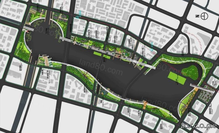
中国-苏州高铁新区滨江带景观规划设计总平面图

 组图打开中,请稍候......
滨水景观带景观规划设计

滨江湿地公园景观设计

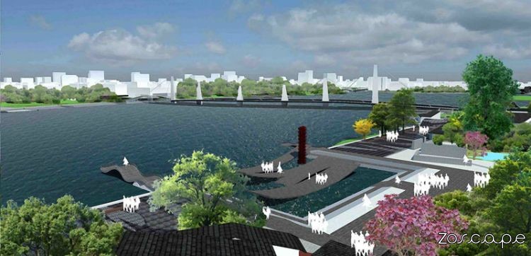
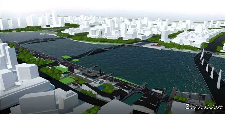
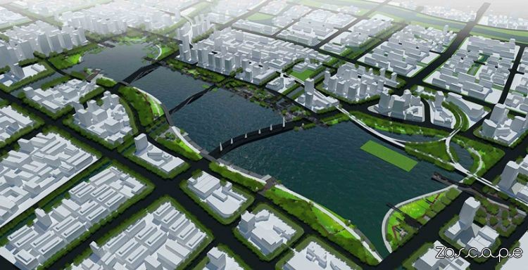
滨水公园景观鸟瞰图意向图

As an important gateway to the north of Suzhou park, landscape planning and design will create a tourism service residential and commercial landscape area. Landscape architect based land use function, combined with urban users planning new urban landscape; This space will accommodate history, culture and nature, and the space around the most important resource for eleven water. New high-speed rail landscape design is a great opportunity for the water into the city and use it to define the city's new image. Huanxiu Lake area divided by many roads, as the classical gardens, like the walls of the space is divided into a plurality of regions, is not conducive to the expansion of modern waterfront activities. To avoid this separation, landscape designers will be accessible land bridge across the road connecting the landscape in the form of regional unbounded connected, so that the formation of a barrier-free urban area waterfront platform.
Landscape Planning in memory and heritage as the main line, to locate on the regional characteristics. Planning along the high-speed rail to North Station Plaza, Cheng Yue Lu 2500 meters of the King is now the axis throughout the Lake District, Suzhou, 2500 on behalf of the development of history. In this axis, we will combine the history and future of Suzhou space node design, Station Leisure Square, memory garden, commercial Roadway, wetlands, gardens, history and future of space to achieve dialogue. The planning of the garden in the memory of this land in the past vegetation, ridge, houses for reservations, reflecting on past memories of this land. Pavement on the axis of the landscape, the local use Metro tiles bricks demolition to be tiled, while looking at the historical build-saving city park.
Landscape design characteristics of the regional land use planning four spatial regions: Station portal Waterfront, Lake district, leisure and fitness area, the Lake ecological zones. Possess unique functional integration, while providing the public with a rich and varied landscape experience.
作为苏州北部重要的门户公园,景观规划设计将打造旅游服务与商业居住风貌区。景观设计师依据用地功能,结合城市使用者规划新的城市景观空间;这个空间将容纳历史、人文与自然,并围绕空间内最重要的资源一一水。 高铁新区的景观设计一大机遇就是将水融入城市并用其定义城市的新形象。环秀湖区域被众多道路所分割,如同古典园林里的围墙一样将空间分割成多个区域,不利于现代滨水活动的展开。为避免这种分离,景观设计师将地块进行无障碍连接以景观桥跨越道路的形式实现区域的无界连接,使区域形成一个无障碍的都市滨水平台。
景观规划以记忆与传承为主线,对区域特色进行定位。规划沿高铁北站广场至澄乐路2500米的景现轴线贯穿整个湖区,代表苏州2500年的发展历史。在这条轴线上我们将结合苏州的历史与未来进行空间节点的设计,站前休闲广场、记忆花园,商业水巷,湿地花园,实现历史与未来的空间对话。在记忆花园的规划中将这片土地过去的植被、田垄、民居进行保留,体现对过去这片土地的回忆。在轴线的景观铺装上,局部利用新城拆迁来的瓦片砖块进行拼贴,在寻找历史的同时打造节约型城市公园。
景观设计根据区域用地特征规划四个空间区域:站前门户滨水区、滨湖商业区、休闲健身区、滨湖生态区。均具备独特功能集成,同时为公众提供丰富多样的景观体验。
|